In looking at the geologic record from a biblical perspective, it quickly becomes apparent that criteria need to be developed and utilized in order to determine if the rocks are pre-Flood, Flood, or post-Flood in nature. Additionally, we expect that there will be an evident Flood boundary that marks the beginning of the Noachian deluge. In the first few centuries after the Flood, catastrophic processes continued to shape the earth’s geologic record. This, of course, gradually declined as the earth sought equilibrium and returned to a more normal state that we are familiar with today. This makes it difficult to determine exactly where the Flood’s record ends and the world’s post-Flood recovery stage begins.
The following article is a summary of “Using Suites of Criteria to Recognize Pre-Flood, Flood, and PostFlood Strata in the Rock Record with Application to Wyoming (USA)” by Dr. John H. Whitmore and Paul Garner, and of the surrounding discussion and research pertaining to it. The views expressed do not necessarily reflect those of New Creation.
Identifying Boundaries in the Stratigraphic Record
Geologist Dr. John Whitmore, along with Paul Garner, have recognized this and attempted to tackle the subject in their 2008 ICC paper. They suggest that entire suites of criteria must be used to determine the nature and age of the strata. They have an extensive list that can help to identify various boundaries in the stratigraphic record.
When looking at any rock layers from a creationist point of view, we want to determine if it was pre-Flood, Flood, or post-Flood deposited. We could expect there to be few fossils and evidence of very little catastrophic geologic activity (though there could have been some post-Fall) in a pre-Flood world. The vast majority of fossil-bearing rock would be laid down during the Flood. The geologic record afterwards, though the thinnest stratigraphically, would have represented the longest period of time. This could be about 4,000 years or so, perhaps a bit longer. Below is the strategy Whitmore and Garner implemented to analyze the stratigraphic record.
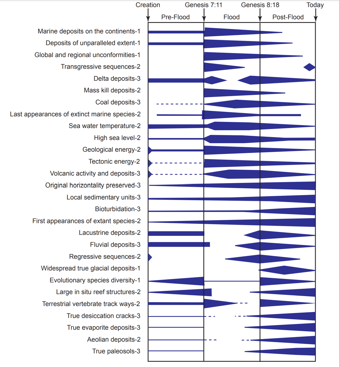
In the figure above, the thickness of each bar represents how likely a certain feature would appear in layer. For example, we would expect to see vast amounts of mass kill deposits at the onset of the Flood; but not in the pre-Flood rocks.
Pre-Flood Strata
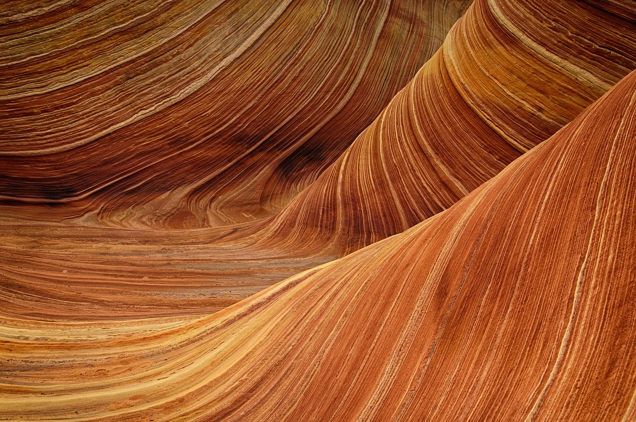
For the pre-Flood world, we would look for what creation scientists have deemed as creation week rocks. These probably would be rocks such as granites and basalts. There might be some geologic activity from when God “made dry land” appear, but for the most part, this period in earth history would likely show little catastrophic tectonic and volcanic activity. We might see evidence of delta deposits or lake deposits, but the Flood could have eroded these features away.
Flood Strata
At the beginning of the Flood, in the rock record, we would most likely see huge evidence of erosion and tectonic activity as the “fountains of the great deep” burst open. So this would be a good way to determine the pre-Flood/Flood boundary; where we see the first signs of catastrophic action. During this period of time, even in the short span of around a year, we should see the most geologic activity.
When looking at an outcrop to determine if it is Flood-deposited strata, perhaps the most obvious thing to look for would be whether it appears to be marine-deposited. We would look for evidence of transgressive sequences and marine deposits on top of the continents. We could expect there to be mass kill deposits in Flood rock, as well as lots of organic material that could form oil, coals, etc. The Flood killed everything that had breath in its lungs, so we should see evidence of huge extinctions.
Post-Flood Strata
The Flood/post-Flood boundary is a bit trickier to determine with certainty. It did not end as dramatically as it began, and for many years and perhaps decades after the Flood occurred, the earth would still be in recovery. However, some markers can give us clues to determine post-Flood strata.
Regressive sequences as vast amounts of water receded off the continents would be indicative that this rock layer would be towards the end of the Flood or be post-Flood. If we see what appears to be a lot of adaptation occurring in different species and kinds of animals, we could predict that deposit to be post-Flood. Since animals would quickly have to adapt to the exceedingly different environment after the Flood, it would make sense for them to have to rapidly change and modify to survive.
After the Flood, too, there most likely still would be a lot of volcanic activity occurring as the continents are recovering from the Flood, so we might find a lot of volcanic deposits in post-Flood rock layers. We also would probably begin to see lacustrine deposits forming during this time. Because the Flood affected the temperature of the entire planet, the ice age happened a few hundred years later, so we would expect to find evidence of a cooling environment, such as glacial deposits.
Application
Researchers have applied this method to the Green River Formation in Wyoming, as an example. Using the suites of criteria, particularly fossil diversification, lacustrine deposits, and terrestrial trackways, Whitmore and others have concluded that the deposit is that of a post-Flood lake.
While biblical creationists would hesitate to use what conventional geology hails as conclusive forms of dating rocks, such as radioactive dating, they can use what Scripture has told us about the past to form a basis for our understanding of the geologic record.


Very helpful summary of Whitmore and Garner’s paper! Another factor to consider is that (unlike the Pre-Flood/Flood boundary which I think one would expect to be nearly isochronous) the Flood/Post-Flood boundary would like vary between geographic locations, especially if we suppose that residual continental motion and isostatic adjustments were is still taking place in the immediate Post-Flood period. The rising of mountain ranges and the final closing of basins like the Tethys Ocean might result in varying degrees of flooding vs drying out of the land. I still wonder whether the supposed Hopi Lake might not represent a basin trapped Floodwaters, in which case perhaps the “Post-Flood” boundary in that region could be said to be the very point where the Grand Canyon was excavated!