When most of us read the Flood narrative of Genesis 6-9, we are awestruck by the destruction of the world that then was, and the incredible grace God bestowed upon the passengers aboard the Ark. Then we breeze past the Tower of Babel and onward to Abraham. But what do we make of the considerable span of time (perhaps hundreds to a thousand years) between the Flood’s end and Abraham’s birth?
The following article is a summary of “The Potential for and Implications of Widespread Post-Flood Erosion and Mass Wasting Processes” by Dr. John Whitmore, and of the surrounding discussion and research pertaining to it. The views expressed do not necessarily reflect those of New Creation.
The Bible says very little about this obscure period of time. Even Whitcomb and Morris’ masterpiece, The Genesis Flood,1 only touched on it briefly. In doing so, they considered the impact that swollen streams, volcanic activity, and even an ice age may have had on the early post-Flood earth. By and large, extensive geologic activity is commonly thought to have been complete by the end of the Flood. Some retellings of the Flood account go so far as to show fully-grown trees and lush forests covering the earth as Noah’s family and the animals exit the Ark. How kind of the greatest cataclysm of all time to have been so gentle as to not knock over a single tree!
A Dynamic Post-Flood World
Catastrophes of Today
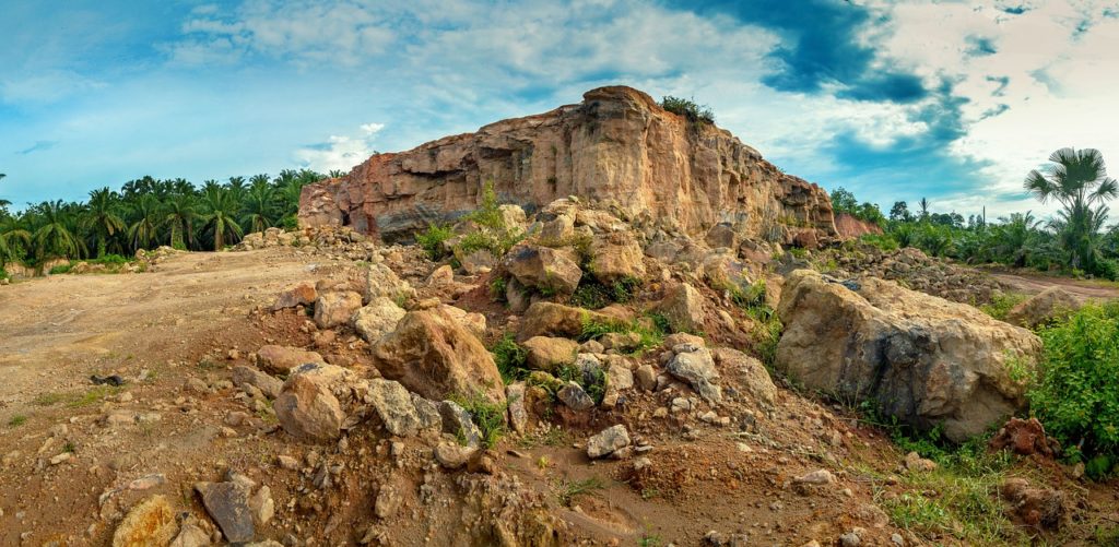
It is quite clear that there has been significant geologic activity since the Flood. Even though the Flood itself was most certainly over by the time Noah stepped off the Ark (Genesis 8:18-19), we still experience horrific catastrophes today. Consider the eruption of Mount St. Helens in 1980, or the Indian Ocean earthquake and tsunami of 2004. These natural disasters and others like them not only cause great devastation, but they also leave a permanent mark on the biology and geology of our planet.
Catastrophes of the Past
There is no reason to think that catastrophes like these wouldn’t have occurred in between the time of the Flood and now. In fact, probably more so. There are some clues from Scripture that this may have been the case. Consider the Book of Job, which makes reference to river torrents that wash away the soil, and the falling and crumbling of mountains:
“But as a mountain falls and crumbles away, And as a rock is moved from its place; As water wears away stones, And as torrents wash away the soil of the earth; So You destroy the hope of man.”
Job 14:18-19, NKJV
If Job is speaking from his own experience, or that of a contemporary, this passage describes the sort of unstable earth conditions we might expect after the Flood. Think about it: we continue to feel the aftershocks of earthquakes weeks, months, or years after they happen. Should we not also expect the earth to experience the aftermath of the biggest cataclysm of all time in the years, decades, and centuries to follow?
Most young-earth geologists believe so! For this reason, they think that a substantial portion of the earth’s geologic record formed after the Flood. Their research suggests that the world between the Flood and Abraham’s birth would have been very unlike the one we experience in the present. That is why many young-earth scientists classify this period of time as its own unique epoch, the Arphaxadian, named after Arphaxad, one of Noah’s descendants.
Mass Wasting
What sorts of geological forces were at work to produce Arphaxadian fossil-bearing deposits? In 2013, geologist Dr. John Whitmore proposed one such mechanism: mass wasting. In geology, mass wasting is a term to describe the downhill movement of rock and sediment under the pull of gravity. This can happen slowly (like soil creeping down a hillside). However, the kind of mass wasting Dr. Whitmore had in mind was more akin to enormous landslides.
Modern-day landslides are devastating in their own right. The largest landslide recorded in history occurred during the 1980 eruption of Mount St. Helens. On May 18, a magnitude 5.1 earthquake turned 2 square miles of mountain into a deadly, catastrophic mudflow traveling at speeds of 69 to 120 mph. Yet even this natural disaster pales in comparison to ones the world experienced after the Flood.
Heart Mountain
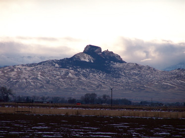
Image Credit: By April – flirting with light and clouds, CC BY-SA 2.0, https://commons.wikimedia.org/w/index.php?curid=2396517
Heart Mountain is currently located in Cody, Wyoming, not far from Yellowstone National Park. But that is not where it originated. Believe it or not, Heart Mountain is actually debris left behind by the largest known terrestrial landslide of all time. Sometime after the Flood, a mass of earth one-third of a mile thick detached from its parent rock and careened 30 miles across the landscape. It traveled almost a hundred miles per hour over a virtually flat slope, all within thirty minutes! The mass broke into more than a hundred pieces along its journey. One of these pieces is Heart Mountain.
Dr. Whitmore suggests that mass wasting processes like these were responsible for reshaping the earth’s surface for centuries after the Flood. As sediment rapidly eroded away in one location, it piled up somewhere else downhill. It may be for this reason that Arphaxadian deposits are quite thick, thousands of feet in some cases. But what triggered this mass wasting? Let’s examine several of the believed mechanisms.
The Rise of Mountains
Does the Bible Imply When Modern Mountains Formed?
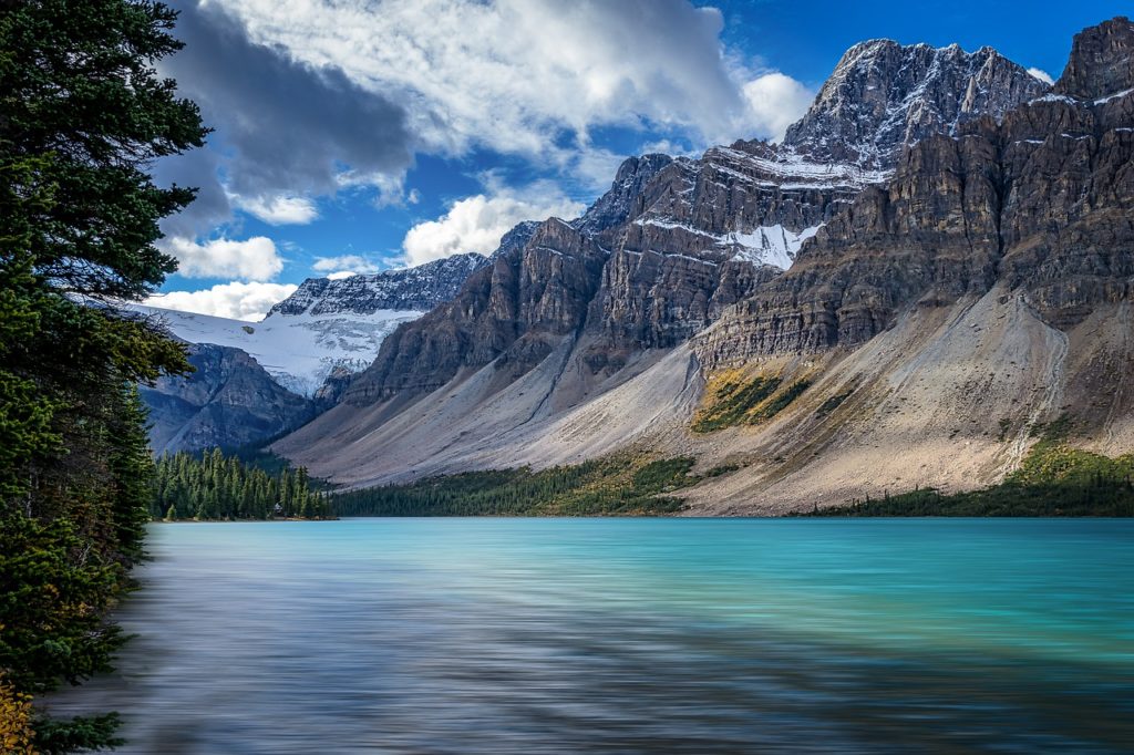
There are several passages in the Bible that may describe geologic processes that could initiate mass wasting. One of them is the uplift and destruction of mountains, as well as subsequent earthquakes, something that the psalmist and Job seem to know a thing or two about:
“You covered [the earth] with the deep as with a garment; the waters stood above the mountains. At Your rebuke they fled; at the sound of your thunder they took flight. The mountains rose, the valleys sank down to the place that you appointed for them.”
Psalm 104:6-8, ESV
“It is God who removes the mountains, they know not how, When He overturns them in His anger; Who shakes the earth out of its place, And its pillars tremble;”
Job 9:5-6, NASB
Mountains after the Flood
This is borne out in the geologic record. The mountains lacing the earth’s crust today, such as the Appalachians, Rockies, and Himalayas, did not exist before the Flood. We know this because the rocks of these mountains are filled to the brim with marine fossils. This means that these “mountainous” regions were underwater basins at the time they were filled in with sediment layers and the fossils they contain. Only during and after the Flood did these areas uplift to form the mountains we are familiar with today. Mountain building could help explain not only the thickness of post-Flood sediment deposits, but also their extent. Even though mass wasting would only accumulate sediment from individual mountain regions within their local vicinity, many mountains rising simultaneously in different parts of the world could account for very widespread sedimentation.
The sediment layers making up these post-Flood mountains are often folded, indicating that they were still wet and pliable at the time of their uplift. Water from the Flood was trapped in the layers. This would have made large-scale mass wasting a much more likely occurrence. Other contributing factors for mass wasting included steep slopes, too few plants, and trees to hold the new soil in place, and especially earthquakes that occurred whilst the mountains were rising. The Heart Mountain landslide was just one of the devastating effects of these mechanisms.
Wind, Rain, and Weather
Genesis 13 records that Abram and his nephew Lot observed the plains of Jordan as well-watered and lush, much like the ‘garden of the Lord’ (Eden) and the land of Egypt at the time. Today, we don’t consider the plains of Jordan or Egypt “well-watered”. These regions were clearly receiving much more precipitation than they are today!
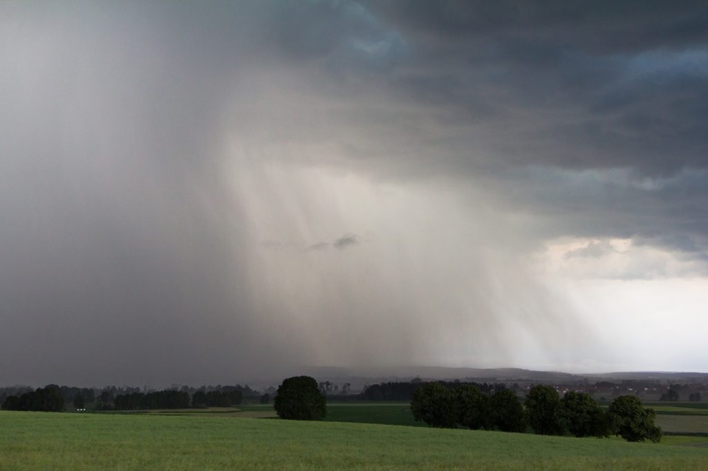
This heavy precipitation was likely the aftermath of the mechanisms God used to initiate the Flood. Volcanic and tectonic activity during the Flood would have left the world’s oceans, even the Arctic, quite warm. This increased evaporation, and therefore precipitation, worldwide. These warmer oceans produced one particularly nasty side effect: much stronger storms. They possessed great destructive power that could reshape the early post-Flood world.
Hypercanes
Hurricanes (also called typhoons and cyclones) still do this today, albeit on a much smaller scale. The Chandeleur Islands, off the coast of Louisiana, were once home to a bustling community of farming and fishing settlements, and even a schoolhouse.2 But hurricanes regularly plagued the islands, so much so that the inhabitants left in the early- to mid-20th century. They never returned. Hurricane Katrina of 2005 was especially devastating, reducing the islands’ size by 86% and turning them into little more than a series of shoals.3 Scientists are concerned that the Chandeleur Islands will be completely beneath the waves within the next few decades.
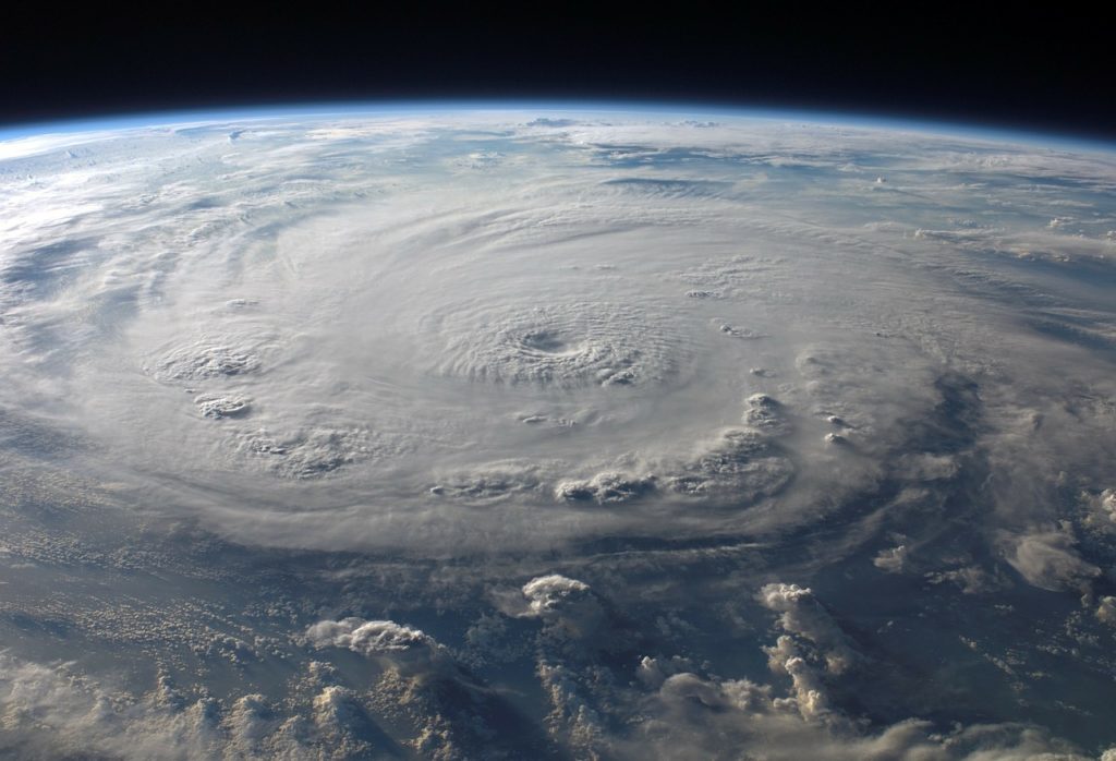
Research by Dr. Larry Vardiman suggests that the warm, post-Flood oceans would have given rise to storms very much like modern hurricanes, except these were the size of entire continents, had wind speeds of 300 mph, and could last for weeks at a time! These were hypercanes, and Hurricane Katrina was a water sprinkler by comparison. Making landfall, the great quantities of rain these storms produced at one time had incredible erosive power. The Appalachian Mountains in the eastern United States are heavily eroded compared to mountains like the Himalayas and the Rockies. Dr. Whitmore suggests that it may have been exposed to hypercanes swooping in from the Atlantic coast. Since all of this eroded sediment had to go somewhere, it would have been deposited in great quantities in basins downhill from mountain and upland areas.
Megafloods
Megafloods in the Bible?
There are passages in the Book of Job that refer to large-scale flooding, ice, and snow, despite the fact that Job lived in the Middle East.
“If He withholds the waters, they dry up; if He sends them out, they overwhelm the land.”
Job 12:15, ESV
“From whose womb did the ice come forth, and who has given birth to the frost of heaven? The waters become hard like stone, and the face of the deep is frozen.”
Job 38:29-30, ESV
“My brothers have acted deceitfully like a wadi, Like the torrents of wadis which vanish, Which are turbid because of ice and into which the snow melts.”
Job 6:15-16, NASB
Ice Age Megafloods
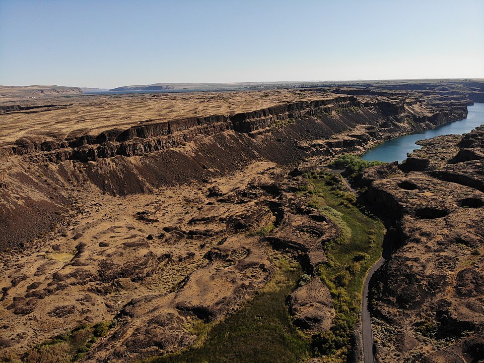
Image Credit: DKRKaynor – Own work, CC BY-SA 4.0, https://commons.wikimedia.org/w/index.php?curid=99266760
If, as many creationists believe, Job lived at some point during the Ice Age, he or someone he knew may have been familiar with the environmental changes and natural disasters brought on by this period of time. You may be surprised to learn that Ice Age megafloods were another factor that lent itself to post-Flood mass wasting.
Lake Missoula was a large lake situated in Montana, restrained by a glacial dam. When the dam gave way, great quantities of water released, carving out the Channeled Scabland of eastern Washington on its way to the Pacific Ocean. Many of the canyons formed in the deluge are almost 1,000 feet (300 meters) deep. The Lake Missoula Flood is the most well-known Ice Age megaflood, but we know others occurred throughout vast expanses of Canada, the English Channel, central Asian mountains, Iceland, and South America. In fact, scientists have identified some 50 megafloods with flows greater than 386 square miles per second. Regional catastrophes like these had great potential to transform entire landscapes. They produced large deltas, deep canyons, and other features that contemporary geologic processes cannot.
Life-Giving Lakes
Great quantities of water dumped during hypercanes and other large storms mentioned earlier formed large lakes across much of the American southwest. Great Salt Lake in Utah is a remnant of one of these lakes: Lake Bonneville, which covered two-thirds of the State of Utah during the Ice Age. When the lake became too full, it breached its northern boundary and deepened the Snake River Canyon on its way to the Pacific. Some geologists think that the Grand Canyon formed in a similar way.
Meteors Incoming!
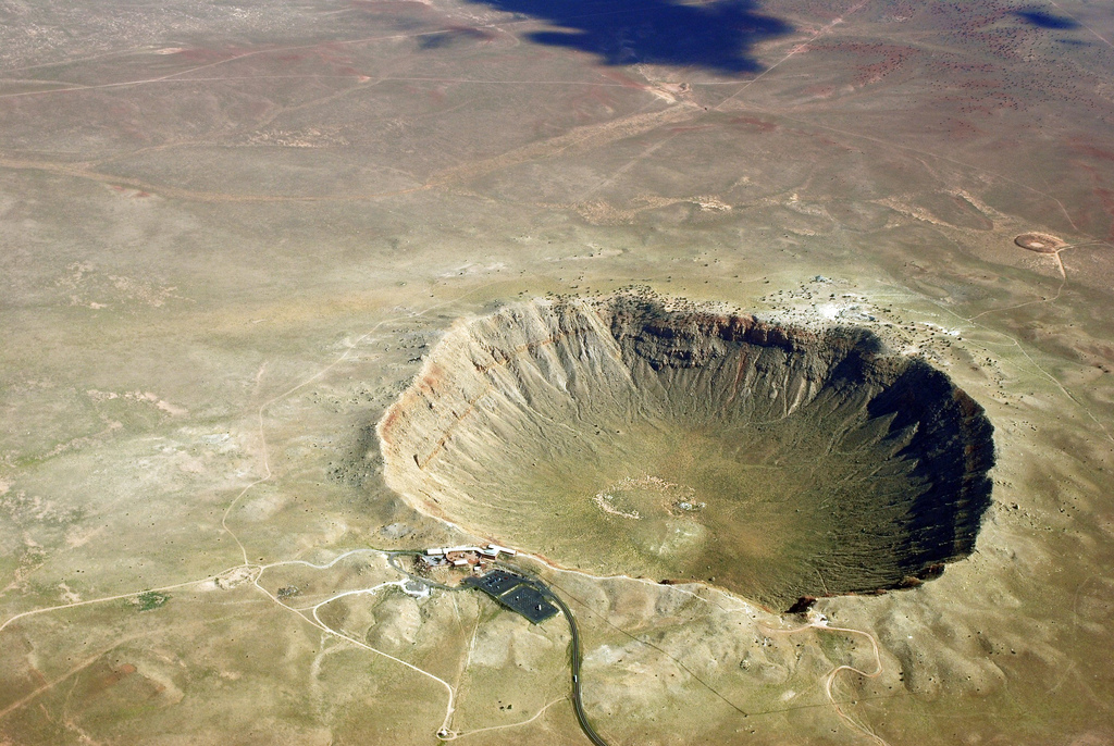
Image Credit: Shane.torgerson – Own work, CC BY 3.0, https://commons.wikimedia.org/w/index.php?curid=12188092
A final, often-overlooked trigger for mass wasting is meteorite impacts. While many would have hit the earth during the Flood, a significant number could have made earthfall in the centuries that followed as well.
Barringer Crater, near Flagstaff, Arizona, is one of the best-preserved and the best known. When the meteorite impact occurred, the space rock left behind a hole 3,900 feet in width and 570 feet in depth, with its rim rising 148 feet above the vast plains surrounding it. The rock responsible for this massive feature is estimated to have been 150 feet across and weighing 300,000 tons; it struck the earth with a force comparable to 2.5 megatons of TNT. That’s 150 times the force of the atomic bomb at Hiroshima.
It isn’t just the impacts themselves that can alter the landscape, but their aftereffects as well. Powerful impacts of particularly large meteorites can cause earthquakes, which in turn can cause more mass wasting. Meteorites making landfall in the ocean could also cause tsunamis, which have the power to devastate coastlines around the world.
“The potential for all of these factors and processes, I believe, led to a very dynamic post-Flood world in regards to geomorphology. Certainly catastrophes have occurred in the recent past, but because of the factors mentioned above, landscape alterations would have been much greater in the years immediately following the Flood…”
Dr. John Whitmore
The Post-Flood Fossil Record
Understanding mass wasting and other examples of post-Flood catastrophism is crucial to helping us figure out how the aftermath of the Flood reshaped the earth. It also helps us better understand the fossil record.
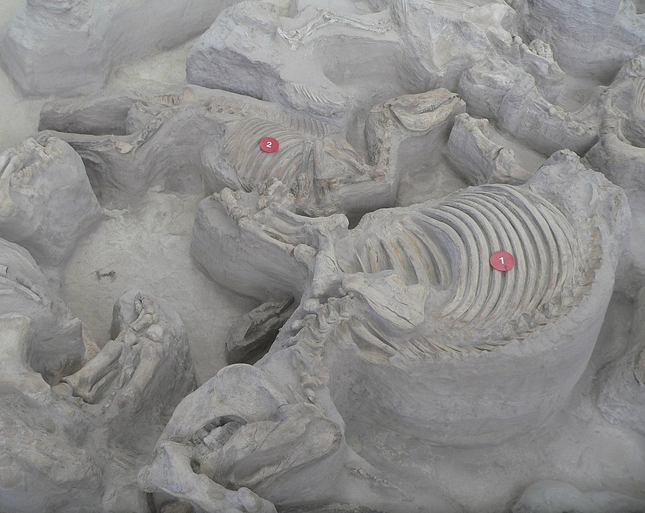
Image Credit: Ammodramus – Own work, CC0, https://commons.wikimedia.org/w/index.php?curid=21305906
While most young-earth creationists attribute much of the fossil record to the Flood, there are many fossil animals that seem to have lived after the Flood. Even Whitcomb and Morris estimated that there may be as many as five million mammoths buried in post-Flood Ice Age deposits,1 not including the other animals. In order to account for such a rich, post-Flood fossil record, some large scale catastrophic processes must have been at work. Mass wasting (and other mega-catastrophes) has the potential to do just that.
As such, a creationist should not restrict their investigations of the fossil record to geologic processes of the Flood. They should also include those before and afterward. Post-Flood catastrophes would preserve ecological communities of plants and animals as they spread around the world and adapted to new environments that arose after the Flood.
Post-Flood Case Study
What is the Green River Formation?
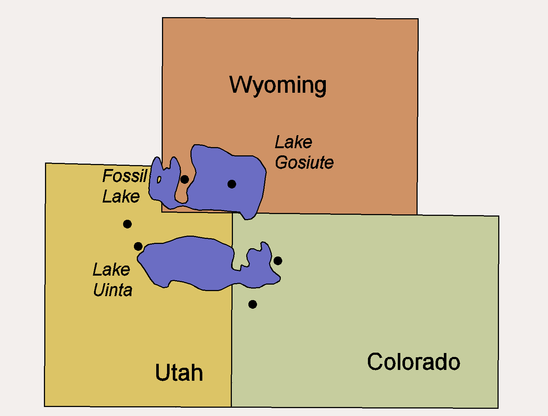
One place where we see Dr. Whitmore’s research on mass wasting applied is the Green River Formation.4 5 6 Located in Wyoming, Colorado, and Utah, this geologic formation consists of three basins situated along the Green River.7
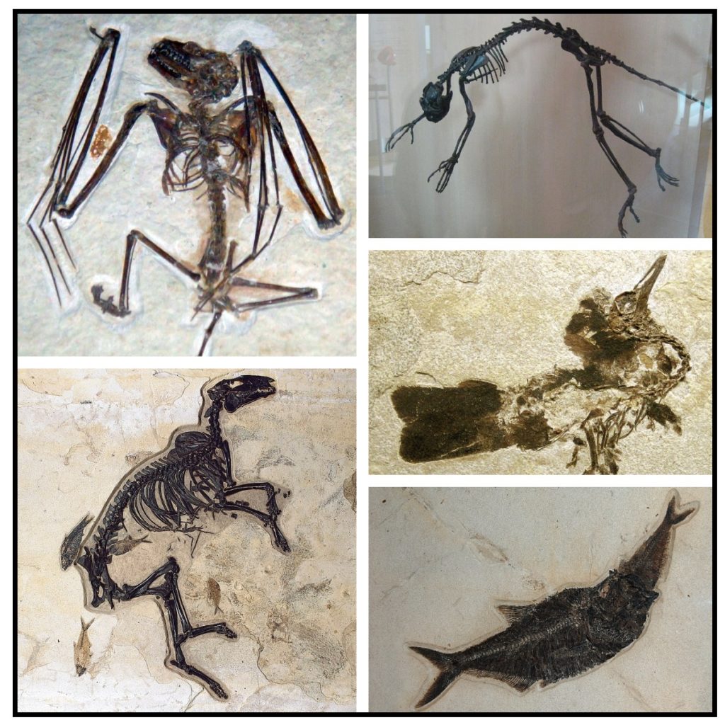
Image Credit7
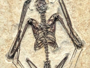
The region is subject to cold, dry, and snowy winters today. However, the fossils of palms, shorebirds, fish, turtles, and crocodiles indicate that the Green River Formation was once warm, wet, and subtropical. Fossils tell us that the area was home to lushly-vegetated forests that served as food for and home to a variety of wildlife,9 including sycamores, early horses, small carnivorous mammals, bats, rhinoceros-like mammals, and insects.
Many of the Green River fossils are well preserved, suggesting a quick burial before they could be eaten by scavengers or decay. It might be tempting for us to argue that this fossil site is direct evidence for the global Flood. However, Dr. Whitmore points out there is much evidence that the Green River Formation formed after the Flood. This includes the formation’s small size, the types of animal and plant fossils found here, and the presence of bird tracks and nests, insect nests, and stromatolites around the edges of the basins.
How did the Green River Formation Form?
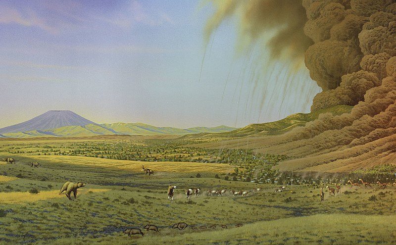
Dr. Whitmore believes that the Green River basins correspond to an intermountain series of post-Flood lake ecosystems. Clearly, these deposits formed after the uplift of mountains like those referred to in Psalm 104:8. Copious precipitation that characterized this era of earth history would have regularly sustained the lake’s water supply. A combination of mountain uplift, heavy rainfall, and earthquakes would have triggered a number of mass wasting events. This freshly-eroded sediment descended into the basin, rapidly burying plants and animals alike. Overtime, the basins would fill in and the lakes would disappear. This process likely happened within a few decades to centuries after the Flood.
After the Green River Formation was laid down, more sediment was deposited on top of it. The entire area was then uplifted by a process called epeirogeny. It rose from about 984 feet to 6,561 feet above sea level, as it is today. Additional mass wasting occurred during its uplift.
Conclusion
Most geologists of the 19th and 20th centuries used present day geological rates and processes to explain all geological features. As such, this caused a widespread rejection of Noah’s Flood and other large-scale catastrophes. Careful study of the geological record has not lessened the impact of catastrophism, though. From the mid-20th century up to now, conventional geologists are begrudgingly returning catastrophism to its rightful role in geology. How can we properly understand the various data in support of catastrophism?
The Arphaxadian epoch was the awkward teenage years of our planet’s history. In some ways, the world was similar to the way it is today. In other ways, it was a very different place as it recovered from the worldwide catastrophism of the Flood. Unique things were occurring at this time, many of which we are only just beginning to understand.
This is where young-earth geologists can step in. Conventional geologists advocate almost rhythmic patterns of catastrophism intercepted by long eras of geologic non-activity. We, on other hand, have a geologic trigger to explain catastrophism: the Noahic Flood. Studying the data and the vulnerable nature of freshly uplifted Flood sediments has great potential for helping us understand the impact of mass wasting. With our thinking grounded on God’s true account of history, we can collect data, propose and test hypotheses, and develop models to understand the world as it was after Noah stepped off the Ark.
Footnotes
- Whitcomb, J.C., Jr. and Morris, H.M. (1961), The Genesis Flood: The Biblical Record and its Scientific Implications, Presbyterian and Reformed Publishing Co., Philadelphia, PA. ↩︎
- Reimann, Nick. “Paradise Lost.” My New Orleans, May 14, 2019. https://www.myneworleans.com/paradise-lost/. ↩︎
- Sallenger, A.H., Jr., Wright, C.W., Howd, P., Doran, K., and Guy, K., 2009, Chapter B. Extreme coastal changes on the Chandeleur Islands, Louisiana, during and after Hurricane Katrina, in Lavoie, D., ed., Sand resources, regional geology, and coastal processes of the Chandeleur Islands coastal system—an evaluation of the Breton National Wildlife Refuge: U.S. Geological Survey Scientific Investigations Report 2009–5252, p. 27–36. ↩︎
- Whitmore, J.H. (2006a), The Green River Formation: A large post-Flood lake system, Journal of Creation, 20(1):55-63. ↩︎
- Whitmore, J.H. (2006b), The geologic setting of the Green River Formation, Journal of Creation, 20(1):72-78. ↩︎
- Whitmore, J.H. (2006c), Difficulties with a Flood model for the Green River Formation, Journal of Creation, 20(1):81-85. ↩︎
- Image Credit: Fish-eating-Fish Fossil, by Tommy from Arad – DiplomystusUploaded by FunkMonk, CC BY 2.0, https://commons.wikimedia.org/w/index.php?curid=24115795 | Bat Fossil, by Andrew Savedra – originally posted to Flickr as DSC00850, CC BY-SA 2.0, https://commons.wikimedia.org/w/index.php?curid=7932477 | Bird Fossil, by James St. John – Fossil bird (Green River Formation, Lower Eocene; Fossil Lake Basin, southwestern Wyoming, USA), CC BY 2.0, https://commons.wikimedia.org/w/index.php?curid=36907042 | Horse Fossil, by NPS – https://www.nps.gov/media/photo/gallery-item.htm?pg=0&id=F189CFBF-155D-451F-6745B84785D26305&gid=f17b1c64-155d-451f-6765341d9b8e553f, Public Domain, https://commons.wikimedia.org/w/index.php?curid=84730000 | Lemur-like Primate Fossil, by Claire Houck from New York City, USA – Notharctus Tenebrosus, CC BY-SA 2.0, https://commons.wikimedia.org/w/index.php?curid=6927358 ↩︎
- Image Credit: Fish-eating-Fish Fossil, by Tommy from Arad – DiplomystusUploaded by FunkMonk, CC BY 2.0, https://commons.wikimedia.org/w/index.php?curid=24115795 | Bat Fossil, by Andrew Savedra – originally posted to Flickr as DSC00850, CC BY-SA 2.0, https://commons.wikimedia.org/w/index.php?curid=7932477 | Bird Fossil, by James St. John – Fossil bird (Green River Formation, Lower Eocene; Fossil Lake Basin, southwestern Wyoming, USA), CC BY 2.0, https://commons.wikimedia.org/w/index.php?curid=36907042 | Horse Fossil, by NPS – https://www.nps.gov/media/photo/gallery-item.htm?pg=0&id=F189CFBF-155D-451F-6745B84785D26305&gid=f17b1c64-155d-451f-6765341d9b8e553f, Public Domain, https://commons.wikimedia.org/w/index.php?curid=84730000 | Lemur-like Primate Fossil, by Claire Houck from New York City, USA – Notharctus Tenebrosus, CC BY-SA 2.0, https://commons.wikimedia.org/w/index.php?curid=6927358 ↩︎
- Whitmore, J.H., and Wise, K.P. (2008), Rapid and early post-Flood mammalian diversification evidenced in the Green River Formation, A.A. Snelling, Editor, Proceedings of the Sixth International Conference on Creationism, Creation Science Fellowship, Pittsburgh, PA & Institute for Creation Research, Dallas, TX, pp. 449-457. ↩︎





Excellent article as organized and from the sources.
I agree YEC rightly must see post flood eath actions as hugh. i say the missoula flood was trivial as compared to the fudson bay flood that stripped all the sedimentary rock off in its direction and created the unique five great lakes in one day. this centuries after the flood. Yes Green valley was a phota of the post flood North america before the ice age event. the biology there is mostly modern central/south american biology. so not pre flood. i don’t see space impacts as relevant. There is a reason for all these great actions i suggest. this to make the land inhospitable to the Asian peoples for migration. thus to confirm the prophecy of Japhet being enlarged. All this, like at babel, done to interfere with mankind. I imagine a great up/down shake of the americas that created mass waste and volcanoes and triggered within weeks the ice age. ruining food options for early asians migrating.
Wow! Monumental geological events! Great take on the prophecy about Kapheth.
Very informative and detailed discussion. I especially enjoyed the post-flood information, as I was not as familiar with this topic. Thank you.
Thank you for the kind remarks, Doug!
Well written and well researched. Its all about your world view. God’s word, or man’s attempt at explanation. Man’s word needs continuous updating. God’s word does not.
Correct verse Psalm 104:6-9 (Not Psalm 108.6-9 as per quote)
Thank you! I have corrected the reference.
I think when the Bible talks about the earth being divided in the days of Peleg (Gen 10:25), there was much continental drift. The hydrosphere below the surface was gone, probably gushed out through the crust into upper stratosphere where it cooled and became a huge amount of snow. That cooling may have occurred very swiftly and not taken hundreds of years.Hence the ice age. Lots of quakes, storms as the crust recovered from a catastrophic flood even. Those ares may have been in the tropics before the Flood or even just after. Snow may have fallen for a long time in northern most areas.
Hello Judy,
There is currently debate among young-earth creationist scholars as to what “division” is being referred to in Genesis 10:25. The consensus is that it is tied to dispersion of people groups from Babel. However, there are some who associate it with the creation of water channels in the Ancient Near East, and others who associate it with post-Flood continental drift. We also have an article on the Ice Age that might interest you here on the blog.