Many young-earth creationists are familiar with the drama surrounding the Channeled Scablands of eastern Washington that started in the 1920’s. For 40 years, geologist J Harlen Bretz, in the face of great opposition, argued that catastrophic flooding scoured this landscape. What many do not know is that there was a very similar dispute that happened much more recently.1 It concerns another geologic feature in California, on the opposite end of the United States: Afton Canyon, East Mojave’s little Grand Canyon.
The views expressed in this article reflect those of the author mentioned and not necessarily those of New Creation.
How Canyons Are “Supposed” To Form
In the 1850’s, few geologists acknowledged the role large-scale natural disasters played in shaping our planet’s surface. Instead, they swapped out such notions of catastrophism for another ideology: gradualism. It remained the ruling paradigm of geology for almost 200 years. One publication states:
“…among geologists in the 1920s, catastrophic explanations for geological events (other than volcanos[sic] or earthquakes) were considered wrong-minded to the point of heresy…The very word ‘Catastrophism’ was heinous in the ears of geologists. …It was a step backward, a betrayal of all that geological science had fought to gain. It was heresy of the worst order.”
Emphasis in original source.2
With minimal exception, geologic features must have had slow and gradual explanations. Was this demanded by the evidence?
This logic extended to the formation of canyons. Canyons often have rivers flowing through them. Today, canyon erosion tends to begin downriver, in lowlands, before working its way upriver, into the highlands. This process is called “headward erosion.” It is a slow and gradual process, taking very long periods of time to carve any significant features into the landscape. So obviously, under the gradualism ideology, this must be how canyons have always formed!
Grand Canyon of the East Mojave
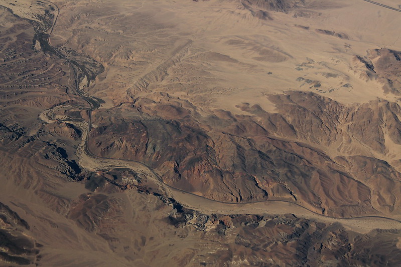
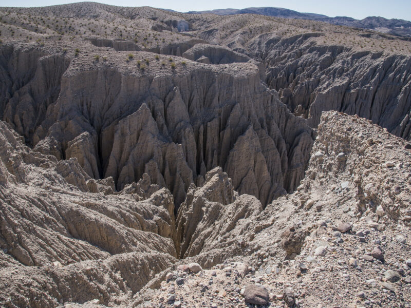
Known to the locals as the “Grand Canyon of the East Mojave,” Afton Canyon is centered along the Mojave River’s journey into the Soda Lake Basin. Like virtually all large canyons, it was clearly the product of slow and gradual erosion by its host river. At least, that was the consensus.
Afton Canyon lies southwest of a basin that once held Lake Manix. This lake once fed a river into Afton. Manix was one of the many lakes dotting the Ice Age landscape of the American southwest. The reason for this “land of lakes” was that precipitation was much higher than it is today. Lake Manix covered an area of about 90 square miles and contained a total volume of three-quarters of a cubic mile’s worth of water.
Rediscovery of Drainage Spillover
When Harlen Bretz succeeded in convincing the geological community that the Channeled Scablands were the result of catastrophic flooding, it changed the game in the geology world. Geologists gradually began to realize that large scale natural disasters could have a big impact in shaping the landscape. But this realization came slowly, begrudgingly. Gradually, if you will. It was still difficult for the reality of catastrophic events to gain a foothold in the geological community. In the 1980s, Norman Meek, a geology graduate, dove headfirst into a very similar dispute as Bretz’s. He discovered 50-year old, forgotten research by geologist Eliot Blackwelder and a student of his named Elmer Ellsworth.

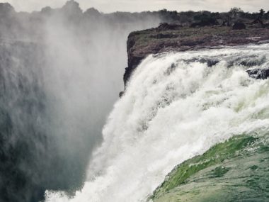
Contrary to the ruling paradigm, Blackwelder and Ellsworth believed that Afton Canyon was carved out by the catastrophic drainage of Lake Manix. After studying the remaining evidence of the lake’s ancient shoreline and lakebed, they argued that the lake emptied catastrophically. The surging water scoured out some 440 feet into the bedrock. This provided a new throughway for the Mojave River eastward through the mountains into Soda Lake Basin beyond. This was a completely different alternative to the headward erosion model. This was the drainage spillover model.
The process leading to drainage spillover occurs when a basin receives more water flowing into it from other sources than it relieves. This forms a lake. There are seldom any exit points for the water in these situations. Eventually, the basin becomes so full that it spills over the basin’s lowest rim and into low-lying areas. Unfortunately, this idea was overshadowed by the conventional understanding that geology must be understood in a slow and gradual fashion. But Blackwelder and Ellsworth’s proposal transfixed Meek.
The Evidence
Meek decided to conduct his own investigation. After studying Afton Canyon and the surrounding area, he identified several lines of evidence that seemed consistent with drainage spillover. Two of the most important are as follows:
1. Lack of Recessive Strandlines
A strandline is the high water mark representing the shoreline of a lake. If Lake Manix drained slowly over a period of years, we should expect to find a series of increasingly smaller strandlines representing the lake as it shrunk in size overtime. Meek reported that no such evidence had been found. According to him, this is the most important line of evidence in support of the rapid carving of Afton Canyon.
2. No Terraces Remain in Afton Canyon
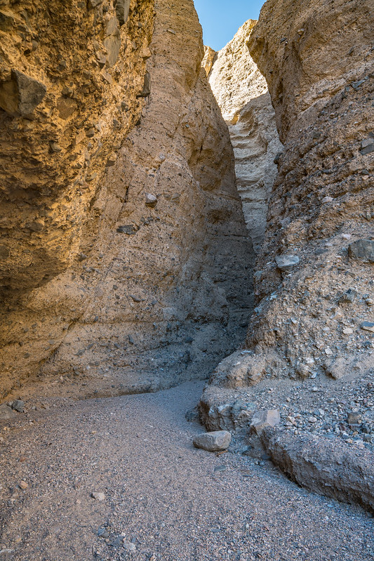
A terrace is a gently sloping surface, typically flanked on one side by a steeper ascending slope. These often form along the edges of floodplains and river valleys as the river meanders over time. If the carving of Afton Canyon occurred episodically over a long period of time, we might expect that terraces formed throughout the canyon at elevations above the floor of Lake Manix. The absence of terraces suggests that most of Afton Canyon was carved too quickly for them to form.
Following in Blackwelder and Ellsworth’s footsteps, Meek published his own research on Afton Canyon and Lake Manix. By 1990, he completed his doctoral thesis on the drainage spillover of Lake Manix.3 While Meek concluded that the carving of Afton Canyon could have taken no more than 500 years, he thought it probably occurred much faster. His more likely estimate is as little as 10 days or three weeks. Water overtopped the lowest rim immediately above baby Afton Canyon and spilled out, removing that part of the canyon above the lake floor in as little as ten hours.4 This is especially notable because Meek is a secular geologist coming to this conclusion, not a young-earth creationist.
The Afton Canyon Controversy
The Plot Thickens
Meek quickly became a bit of a crusader for drainage spillover. But despite his best efforts at the time, other geologists remained unconvinced. Drainage spillover went against everything geologists had believed about the origin of canyons.
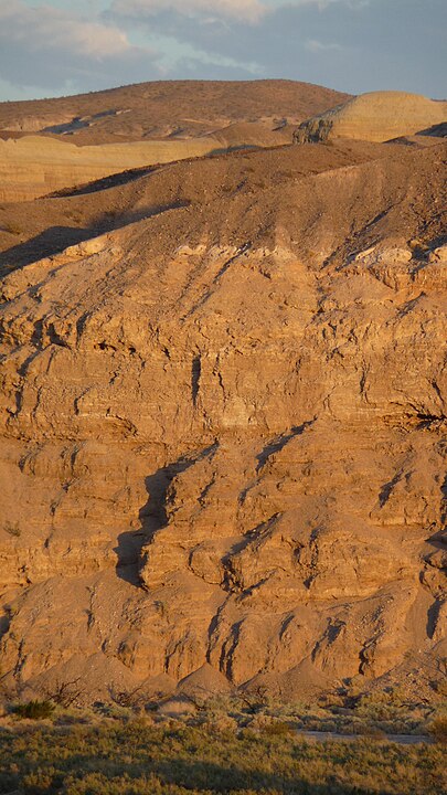
Starting in 1994, three geologists challenged Meek’s Afton Canyon model: Yehouda Enzel, Stephen G. Wells, and Nicholas Lancaster. Chief among their arguments went straight for the heart of Meek’s model: they reported recessive strandlines along what was once the bottom of Lake Manix. They also identified terraces throughout Afton Canyon. Both of these observations, they argued, were most consistent with the carving of Afton Canyon occurring over a much longer timescale of thousands of years.5
Their criticisms did not convince Meek. He noted that they incorrectly asserted that he believed Afton Canyon was carved to its current depth in a single event. This is incorrect. He argued that only portions of the canyon having equal or greater elevation than the floor of Lake Manix were the result of this carving event. As such, he affirmed the existence of terraces in Afton Canyon, but also pointed out that all of them occur below the elevation of the lake floor. This makes sense because these formed well after the rest of Afton Canyon. More importantly, his critics’ assurance of recessive strandlines perplexed Meek, because none of them reported the locations of any of these strandlines.6 Meek refused to go down without a fight. By the dawn of the 21st century, the Afton Canyon Controversy was in full thrust.
The Controversy Settles
Before long, the United States Geological Survey (USGS) became involved. By the mid-2000’s, they had become equipped with extremely detailed mapping equipment. With the use of special GPS and LiDar technology that did not exist in the 90’s, they successfully remapped the floor of Lake Manix with errors of less than a meter. The USGS reported that they “found no unequivocal remnants of recessional shorelines…to suggest lake stillstands during incision [of Afton Canyon].” Furthermore, they stated that “we interpret the soils, stratigraphy, and fluvial landforms in the canyon to indicate relatively rapid incision of Afton Canyon to the depth of the bedrock floor, followed by intermittent, more gradual bedrock incision.”7 This was third-party confirmation that not only was Meek correct, but so were Blackwelder and Ellsworth before him!
What Can We Learn from the Afton Canyon Controversy?
Overflow of Evidence
Afton Canyon is far from the only example of canyons for which drainage spillover is the best explanation. Geologists have identified many others in the years after the Afton Canyon Controversy began. They describe the San Venanzio Gorge in Italy as a spillover channel,8 and they have identified similar channels as deriving from Kashmir Lake in India9 and Roosevelt Lake in Arizona.10 Amazingly, evidence for drainage spillover is not limited to planet earth. One study identified a crater on Mars that seems to have been filled with water that overflowed, forming an exit channel.11
Despite the overflow of evidence, drainage spillover explanations were, and still are, lampooned by many geologists. Why? The critics of Meek’s Afton Canyon model received some “polite” criticism of their own in a recent paper by geologist Zach Hilgendorf and his colleagues, who came to Meek’s defense. They described the critics’ knee-jerk reaction as the product of “a pedagogically engrained bias.”
Bias in the Books
Meek identified two likely factors for this bias.12 One is that geologists approach the data with the expectation that they should find direct evidence for the lake that overspilled. This will include, for example, the presence of clay deposits that often form along lake bottoms. The absence of this evidence, they believe, argues that the spillover event did not happen because the lake itself never existed. Meek points out that this presupposition is flawed because such lake deposits usually quickly erode away after the lake drains. This is why Meek appealed to other evidence for Lake Manix’s existence, specifically the lack of recessive shorelines.
Another factor is the education of geologists itself. Meek discovered that geology textbooks do not discuss drainage spillover as a plausible explanation for the origination of canyons and other geologic features. In 2002, he reported that 23 introductory textbooks on physical geography, physical geology, and geomorphology he examined did not contain any mention of canyon erosion mechanisms, let alone drainage spillover.13 He published a similar investigation in 2013, with similar results. This time, however, some did propose mechanisms for canyon erosion, but only those consistent with the headward erosion paradigm.14
Meek concluded that the out-of-hand rejection of drainage spillover models is part of a larger problem relating to the education process of geology students. Hilgendorf and his coauthors sum up this problem:
“While textbooks cannot be comprehensive for any broad field of study, the increasing omission of transverse drainage discussions, and the continued omission of spillover as a possible transverse drainage hypothesis hints at a larger problem related to selective textbook content and a constrained paradigm that does not inform adequately about fundamental river development mechanisms.”15
Where Do We Go From Here?
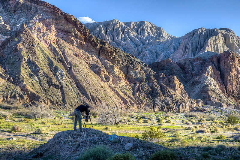
Indeed, rocks cannot lie. But this is because they also cannot speak in the first place. Much of what we learn about geologic history is deduction based on inferences made regarding observable data seen in the rock record. As such, these deductions are always subject to the paradigms we use to interpret data, and the data can be misinterpreted.
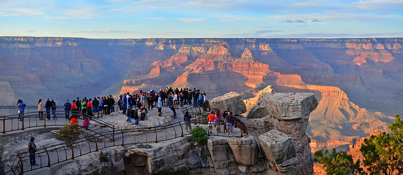
We, however, can learn from our mistakes. The paradigm that required geologic processes to be no more catastrophic than those observed in the present began to shift in the mid-20th century and continues today. By taking what we have learned from past and present evidence of large scale natural disasters, we can better interpret other geologic marvels. How can we apply the lessons we have learned from Afton Canyon? Could we apply these to much larger canyons such as the Grand Canyon?
Afton Canyon is one-tenth the size of the Grand Canyon. Nevertheless, Meek observes many similarities between the two. The exceedingly steep channels and heightened topography that occur upstream of each respective canyon are very reminiscent of each other. Meek refers to both as displaying “canyonland topography.”16 And both lie just downstream of lakes. Is it possible that the Grand Canyon formed in a similar way, by drainage spillover? Meek, and his forebear Blackwelder, have some interesting things to say about the Grand Canyon as well. But that is a story for another time!
Footnotes
- Morris, J. 2011. The Channeled Scablands. Acts & Facts. 40 (10): 15. ↩︎
- Allen, E. A., et al., 1986, Cataclysms on the Columbia, Timber Press, Portland, OR. ISBN 978-0-88192-067-3, pp 42-44. ↩︎
- Meek, Norman. 1990. Late Quaternary Geochronology and Geomorphology of the Manix Basin, San Bernardino County, California. Ph.D. diss. University of California, Los Angeles, California. ↩︎
- Meek, Norman. 1989. “Geomorphic and Hydrologic Implications of the Rapid Incision of Afton Canyon, Mojave Desert, California.” Geology 17, no. 1 (January 1): 7–10. ↩︎
- Wells, Stephen G., William J. Brown, Yehouda Enzel, Roger Y. Anderson, and Leslie D. McFadden. 2003. “Late Quaternary Geology and Paleohydrology of Pluvial Lake Mojave, Southern California.” In Paleoenvironments and Paleohydrology of the Mojave and Southern Great Basin Deserts. Edited by Yehouda Enzel, Stephen G. Wells, and Nicholas Lancaster, 79–114. Geological Society of America Special Paper 368. Boulder, Colorado: Geological Society of America. ↩︎
- Meek, N. (2004). Mojave River history from an upstream perspective. Breaking Up: The, 41-49. ↩︎
- Reheis, Marith C., and Joanna L. Redwine. 2008, “Lake Manix Shorelines and Afton Canyon Terraces: Implications for Incision of Afton Canyon.” In Late Cenozoic Drainage History of the Southwestern Great Basin and Lower Colorado River Region: Geologic and Biotic Perspectives. Edited by Marith C. Reheis, Robert Hershler, and David M. Miller, 227–259. Geological Society of America Special Paper 439. ↩︎
- Ganjoo, R. K. (2014). “The vale of Kashmir: landform evolution and processes.” In Landscapes and landforms of India (pp. 125-133). Springer, Dordrecht. ↩︎
- Geurts, A. H., Cowie, P. A., Duclaux, G., Gawthorpe, R. L., Huismans, R. S., Pedersen, V. K., & Wedmore, L. N. (2018). “Drainage integration and sediment dispersal in active continental rifts: A numerical modelling study of the central Italian Apennines.” Basin Research, 30(5), 965-989. ↩︎
- Larson, P. H., Meek, N., Douglass, J., Dorn, R. I., & Seong, Y. B. (2017). “How rivers get across mountains: Transverse drainages.” Annals of the American Association of Geographers, 107(2), 274-283. ↩︎
- NASA. (2018) Crater tadpoles Retrieved from https://www.jpl.nasa.gov/spaceimages/details.php?id=pia22241. ↩︎
- Meek, N. (2002). Ponding and Overflow, the Forgotten Transverse Drainage Hypothesis. In the 98th Annual Meeting Abstracts, Association of American Geographers, March, Los Angeles, CA, pp. 19-23. ↩︎
- Meek, 2002, 19-23 (Footnote 12). ↩︎
- Meek, N. 2013. “On the Demise of Transverse Drainage in Geoscience Textbooks. In 109th Annual Meeting Abstracts, Association of American Geographers, April, Los Angeles, CA, pp. 9-13. ↩︎
- Hilgendorf, Z., Wells, G., Larson, P. H., Millett, J., & Kohout, M. (2020). “From basins to rivers: Understanding the revitalization and significance of top-down drainage integration mechanisms in drainage basin evolution.” Geomorphology, 352, 107020. ↩︎
- Meek, Norman. 2019. “Episodic Forward Prolongation of Trunk Channels in the Western United States.” Geomorphology 340 (1 September): 172–183. ↩︎





Interesting story and a good cautionary tale to anyone – regardless of where you stand. I’ve certainly seen my share of “tunnel-vision” in some geologists I’ve worked with (and I’m probably guilty of it as well).
After reading this, I was trying to find out about the geology of the Afton Canyon, with limited success. The upper levels appear to be weakly consolidated gravels with more competent, older rocks lower down the canyon. Also, an active fault is associated with the Afton Canyon water gap. Looking at the Grand Canyon, some of the side branches are most likely fault-related, but much of the main channel is not.
I realize this was not the main thrust of the article.
Great article on geomorphology. So many important points about fast actions being the true origin for carving into bedrock or anything. then the incompetence of researchers including a rejection of fast things possibly because they want deep time and smell creationist criticisms out there.
Yes all bedrock carving was fast and furious. Actually these small canyons are chump change. i suggest the greatest post llood bedrock carving was from the arctic that in a single day created Hudson Bay and the great lakes as is the origin for the error there was a great glacier over north america. instead it was just from megafloods from much further north. Its about physics and not trivial physics of water over rock.
Catastrophic geologic events are not as controversial as you make them (maybe they were a hundred years ago…that was a hundred years ago). But if you are going to go this route, then you should talk more about the catastrophic glacial outflows from lake Missoula 13K to 15K years ago, with fragmentary evidence of outflows going back 1.5 million years. The evidence for catastrophic events through geologic time is definitely not good for young earth creationism. And don’t even get me started about the Mt. Toba eruption…
Just because mainstream geologists accept catastrophes in principle, that does not mean they are predisposed to accept catastrophic processes for every geologic phenomenon. Slow and gradual processes are still the rule of thumb in old earth geology, with the odd large-scale catastrophe happening every once a blue moon. In fact, everything discussed in this article regarding the Afton Lake controversy took place within the 90’s and early 2000’s, not “a hundred years ago.” And there are still debates amongst old-earth geologists happening right now for whether certain geologic features were formed gradually or catastrophically. The origin of the Grand Canyon is a prime example that we will be discussing in an upcoming article here on the blog.
P.S. I actually did bring up the catastrophic glacial flooding from Lake Missoula. It is mentioned in the very first paragraph of the article.
There was no 1.5 MYA!
Missoula formed during The flood and emptied just as the lake at Mt St Helens did.
I suspect there may be “truth” in geology, room for both “long term” & “short term” events and that both have happened at the same time in various rates and places. God is the greatest and only true god and can make things happen in the best way possible … after all, he created it all. IMHO